Thursday, May 31, 2012

Belhaven, NC to Coinjock, NC

Island Hopper departed Belhaven at 7:50 AM.  The skies were sunny with winds S 5-10.  The cruise to Coinjock was 88.5 miles and arriving at Coinjock Marina at 2:30 PM.  Note the tea colored water from the leaching of the tannins from the trees in adjacent marshes.


Island Hopper's Wake


Arriving At Coinjock


Coinjock Marina Restaurant has been a favorite of locals and traveling yachtsmen alike since 1978.
Serving only the freshest local seafood available, the Coinjock Marina Restaurant is also known as "Home of the 32oz prime rib".
Overlooking the Intracoastal Waterway, Coinjock Marina Restaurant provides a dining experience with great view of yachts and sailboats plying the waterway.
Our friendly courteous staff are waiting to serve you with daily lunch and dinner specials - along with a full featured regular menu.
If you enjoy outdoor dining, Coinjock Marina Restaurant features a new expand outdoor deck, where you can enjoy the waterfront views, while partaking of your favorite ice cold refreshments along with your meal.
So whether you are looking for seafood, award winning prime rib, make Coinjock Marina Restaurant your choice for upscale dining in a casual atmosphere.


Located conveniently on the Intracoastal Waterway at Mile Marker 50, the Coinjock Marina has been a longtime favorite for transient yachtsmen traveling north and south along the waterway.
With all the amenities you would expect from a world class marina the staff of Coinjock marina demonstrates a willingness to accomodate your every need so that we make your stay a memorable one.
With newly refurbished docks, an easy approach with alongside dockage, and a highly acclaimed dockside restaurant, you will soon see why thousands of visitors say that Coinjock Marina is truly one of their favorite stops.


Wednesday, May 30, 2012

Tropical Storm Beryl Belhaven, NC


Skies After The Storm


MV Island Hopper stayed in port at Belhaven Waterway Marina, Belhaven, North Carolina due to around 6 inches of rain from Beryl, the tropical storm.  After the storm the crew walked into town.  There was not a business or restaurant open.  After a walk through town, the crew returned to the boat for dinner.  It was a relaxing and catch up day aboard Island Hopper.


Island Hopper at the Dock


Belhaven After The Storm


Clearing Skies

Tuesday, May 29, 2012

Day 24 Morehead City to Belhaven, NC

We departed Morehead City Marina at 810 which was late for us, but I needed to stop at the marine store which opened at 730.  The crew enjoyed a second pot of coffee.

We fueled up also. Diesel fuel prices have fallen 60 cents since we left Sarasota. Now $3.49 per gallon.
We wanted to move north away from the projected path of T/S Beryl.  The second storm to dodge this trip, the first was Alberto.  The initial bands we headed our way as we saw on the Sirius weather service and looking ahead!

Because of Beryl we decided to stay two nights in Belhaven.

We traveled 68 miles most at 20 mph as we were in larger rivers and the holiday folks have headed home.  Total miles to date 1089.
Along one of the cuts we traversed a small pirate ship was tied up behind a home.
We used radar and the Sirius weather to track the storms. We dodged most of them but a few showers hit us, no big deal.
Of course as soon as we arrived at the marina in Belhaven, the winds picked up and a small squall hit. We motored slowly waiting for it to pass.  When it did pass  the crew prepared the lines for our docking.  The Captain was nice and dry in the bridge.

WE decided to grill steaks at the marina. They provided a great gas grill for our use. Since there is only one restaurant in town (two have closed since our last visit in 2009) we thought we would visit it tomorrow.

Monday, May 28, 2012

Monday May 28 Day 23 Topsail Island to Morehead City


While at Topsail Island (Surf City) we enjoyed walking on the beach which was only 2 blocks away. Since it was Memorial Day weekend it was very busy on the beach and on the waterways.  Normally I do not like to move on holiday weekends, just too many boats and people.


The marina at Topsail had a few tour boats tied up. We were next to one of them.  Very handy
Marina to the sights though.
A character on the street "working" for tips.  I asked him how much it would  cost for him NOT to sing.


We were able to find a very nice restaurant in Surf City.  Luckily we got a table with short notice.
We departed Topsail at 0740 trying to beat the fishermen and party folks.  The fisherman beat us out.  We traveled 59 miles to Morehead City, NC (next to Beaufort) most at slow speed due to traffic.  Also we had two bridges that only opened on the hour and half hour. We timed them well thanks to the GPS and chartplotter.  Total miles to date 1020.

This house was along the waterway.
The waterfront at Morehead city is all about tourists and sport fishing.  An inlet nearby makes it very convenient for the boats to enter the Atlantic to go for the big fish.

Sunday, May 27, 2012

Island Hopper departed Southport Marina, Southport, NorthCarolina at 7:15 AM heading to Topsail Island, NC.  Sunny Skies with winds 10 NE.  It made for a beautiful morning on the water.

<>

Topsail Beach, NC


About Topsail Beach

Situated at the southern end of Topsail Island, off the coast of southeastern North Carolina, the Town of Topsail Beach is the smallest of the three communities located on the 26-mile long island. North Topsail Beach occupies the northernmost section, and Surf City, the largest town on the island, is in the center. The Island is just off US Highway 17, about half-way between Wilmington and Jacksonville.
Topsail Island has a rich and varied history. Local folklore claims the name, Topsail (pronounced Tops’l), originated during the 1700’s when pirate ships roamed the coastal waters. Historians explain that marauding pirates hid their ships in the channel behind the island and waited for passing merchant ships loaded with goods. The pirates would pursue and attack the merchants, claiming the cargoes as their own. Eventually the merchants became aware of this infamous hiding place and began to watch for the tops of the pirates' sails showing over the rolling dunes - hence the name Topsail Island.
Prior to World War II, the only access to Topsail Island was by boat. Area residents frequently made this short trip and picnicked on the sandy shores of the Atlantic Ocean. Local farmers are said to have driven their livestock across the waterways to graze on wild grass. Treasure hunters searched for Blackbeard’s infamous buried treasure throughout the maritime forests which covered the island.
During the war, the U.S. Navy took over the island and began a joint venture with Johns Hopkins University known as Operation Bumblebee. The waterway was dredged, roads were built, and fresh water was piped onto the island. Operation Bumblebee was the beginning of the space program for the United States Government. An arsenal center for the assembly and storage of rockets was built on the sound side of the island, and launching pads were constructed on the oceanfront. Concrete observation towers were built throughout the island to monitor the experimental launchings. Over 200 rocket launchings took place on the island between 1946 and 1948. When the testing program was dismantled, the government sold the island to the public. Many of the original military structures are still standing.
Incorporated in 1963, the Town of Topsail Beach boasts a friendly, family oriented style of beach living. High rise development is not allowed, beautification is encouraged, and conservation of the island environment is a top priority. There are over 1200 homes, but only about 500 year-round residents. The seasonal influx of tourists increases the population to about 7,000, which helps sustain the town's motels, restaurants, gift shops, fishing pier and other businesses. The only sea turtle hospital in the state, the Karen Beasley Sea Turtle Rescue and Rehabilitation Center, is located on the sound near Town Hall. The arsenal (Assembly) building from Operation Bumblebee now houses the Missiles and More Museum as well as a meeting room that is available for rental.

All this and more truly make Topsail Beach a wonderful place for a visit or a lifetime!

Saturday, May 26, 2012

North Myrtle Beach, SC to Southport, SC

Island Hopper departed the dock at Barefoot Landing Marina at 7:30 AM with foggy conditions.  Navigating the intercoastal channel was a slow go due to numerous boats, sea doos and docks.  The wind continued to build with winds consistently NE 25 gusting to 35.  Captain Kevin chose to duck in at the new Southport Marina in North Carolina making today's cruise 45 miles instead of the originally planned 71 miles. The intended trip was to go to Wrightville Beach, NC, but with gusting winds and the Cape Fear River ahead of us, the wind on Island Hopper's nose and large white caps, docking before the weather conditions became stronger was a great decision.  Captain Kevin did a great job docking the boat in strong winds and a small area. As always the crew adapted to the new situation and walked into the town. They had a late dinner at Mr. P's Bistro.  The number one rated restaurant in Southport.


Southport Marina, NC

The entire facilities at Southport Marina underwent extensive renovation and upgrades between 2006 and 2008, making this one of the largest and most amenity-laden marinas in North Carolina. Southport Marina is a "must see" destination while traversing the East coast waterways. Our location puts you within a day’s travel of Wrightsville Beach, NC and Myrtle Beach, SC. As well as with walking distance of downtown Southport, NC

Conveniently located on the Intracoastal Waterway at mile 309, Marker 2A, the full service marina has over 200 in-water protected slips with deep water access, a floating dock house and a transient / fuel dock. The new 50', 220 unit dry-stack facility has a travel lift capable of handling up to 75 tons and two 10 ton forklifts


Southport, North Carolina
City
A view of Southport from the fishing pier


Southport, North Carolina is located in North Carolina
Southport, North Carolina
Location within the state of North Carolina
Coordinates: 33°55′28″N 78°1′14″W / 33.92444°N 78.02056°W / 33.92444; -78.02056Coordinates: 33°55′28″N 78°1′14″W / 33.92444°N 78.02056°W / 33.92444; -78.02056
CountryUnited States
StateNorth Carolina
CountyBrunswick
Established1792
Area
• Total2.3 sq mi (5.8 km2)
• Land2.2 sq mi (5.7 km2)
• Water0.1 sq mi (0.1 km2)
Elevation20 ft (6 m)
Population (2000)
• Total2,351
• Density1,059/sq mi (408.9/km2)
Time zoneEastern Time Zone (North America) (UTC-5)
• Summer (DST)EDT (UTC-4)
ZIP code28461
Area code(s)910
FIPS code37-63400[1]
GNIS feature ID1022722[2]
WebsiteCity of Southport
Southport is a city in Brunswick County, North Carolina, near the mouth of the 
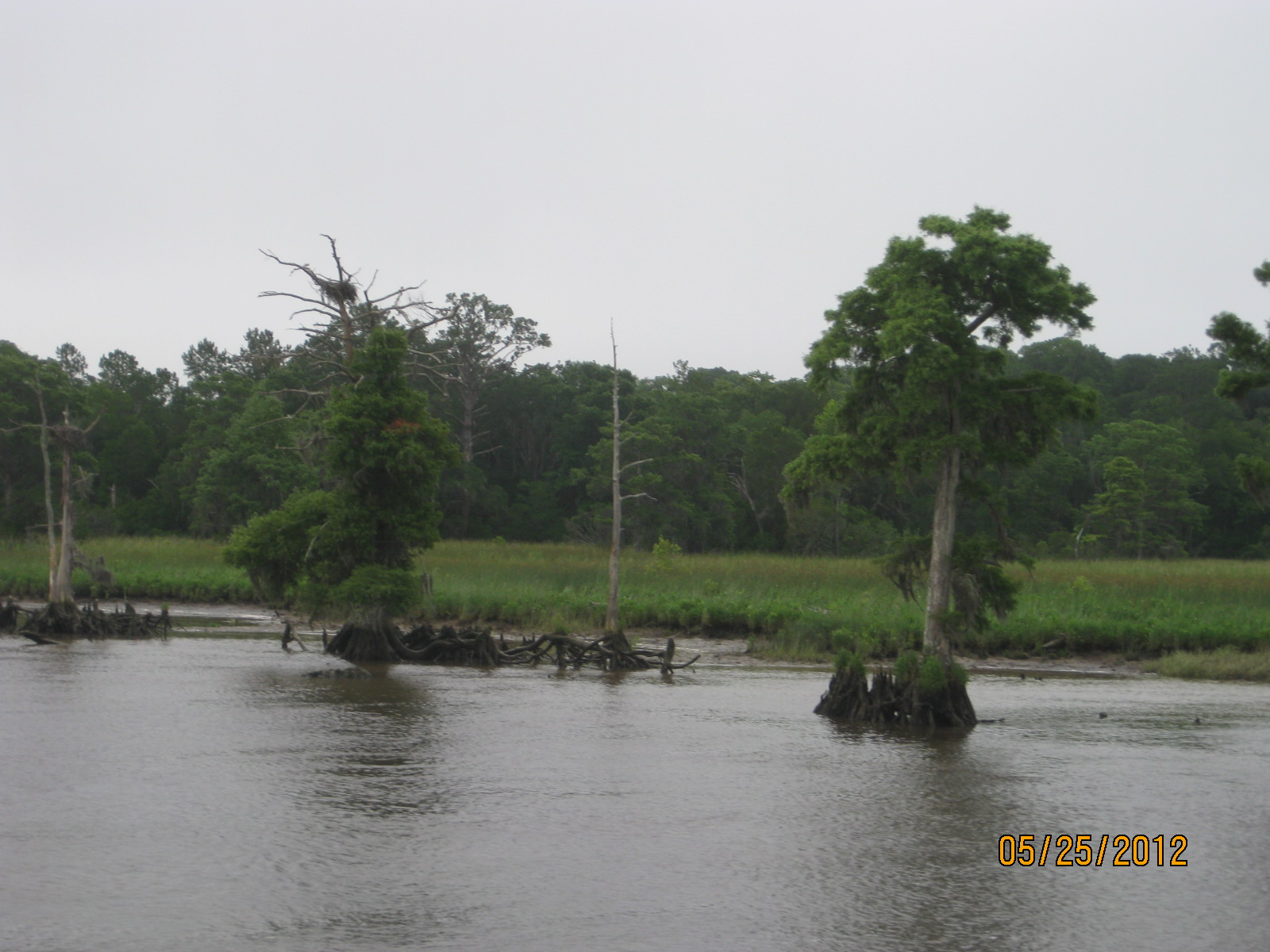
Cape Fear River. It is part of the Wilmington Metropolitan Statistical Area. Its population was listed as 2,351 for the 2000 census.
A popular filming location for television and movies, the small town can be seen in the television show "Dawson's Creek" and the movies "I Know What You Did Last Summer", "Summer Catch", "Domestic Disturbance", "Crimes of the Heart", "Nights in Rodanthe" and "A Walk to Remember", among others.
Southport hosts a Fourth of July festival of North Carolina. Every year vendors from all around the country travel to Southport for four days of fun and excitement downtown.
It is the site of the proposed North Carolina International Port, and its Southport Marina has been the subject of media attention surrounding its possible sale.
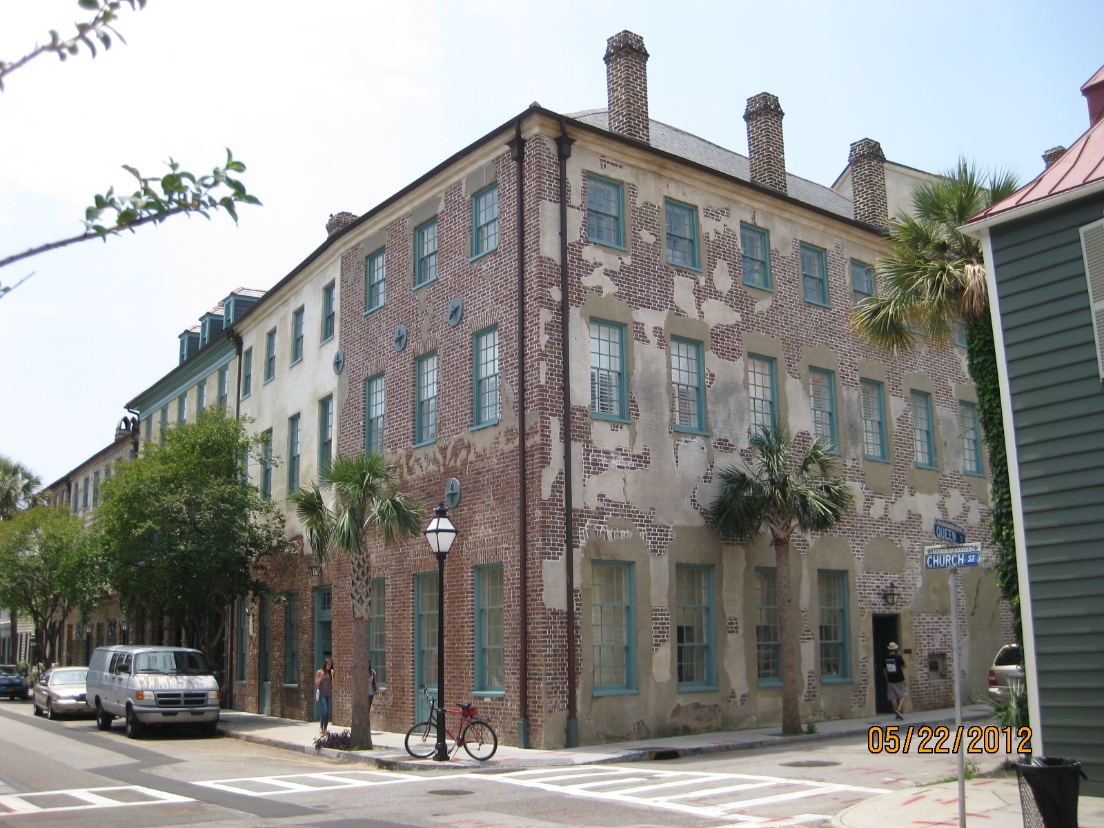
 History

The Southport area was explored as early as the 1500s by Spanish explorers. Before the construction of Fort Johnston, British settlements along the Carolina coast lacked fortifications to protect them against pirates and privateers, and numerous Spanish attackers exploited this weakness. In response to these attacks, Governor Gabriel Johnston in 1744 appointed a committee to select the best location to construct a fort for the defense of the Cape Fear River region. France meanwhile declared King George's War against Britain in 1744. The Governor of South Carolina agreed to lend ten small cannons for the fort. Facing increasingly bold Spanish privateer raids, the General Assembly of North Carolina colony in April 1745 authorized the construction of "Johnston's Fort" near the mouth of the Cape Fear River. In spring 1748, the legislature appropriated 2000 pounds for construction costs, and people finally began building Fort Johnston. Southport developed around Fort Johnston and was originally named Smithville.[3]
From 1808 to 1977, Smithville, renamed Southport in 1887, was the county seat of Brunswick County.[4][5]

Geography

Southport is located at
WikiMiniAtlas
33°55′28″N 78°1′14″W / 33.92444°N 78.02056°W / 33.92444; -78.02056 (33.924484, -78.020513).[6]
According to the United States Census Bureau, the city has a total area of 2.3 square miles (6.0 km2).2.2 square miles (5.7 km²) of it is land and 0.04 square miles (0.10 km2) of it (1.77%) is water.

Demographics

As of the census[1] of 2000, there were 2,351 people, 1,095 households, and 676 families residing in the city. The population density was 1,059.0 people per square mile (408.9/km²). There were 1,292 housing units at an average density of 582.0 per square mile (224.7/km²). The racial makeup of the city was 76.61% White, 21.78% African American, 0.43% Native American, 0.17% Asian, 0.09% Pacific Islander, 0.21% from other races, and 0.72% from two or more races. Hispanic or Latino of any race were 1.45% of the population.
There were 1,095 households out of which 19.3% had children under the age of 18 living with them, 45.3% were married couples living together, 14.0% had a female householder with no husband present, and 38.2% were non-families. 35.3% of all households were made up of individuals and 16.2% had someone living alone who was 65 years of age or older. The average household size was 2.08 and the average family size was 2.65.
In the city the population was spread out with 17.9% under the age of 18, 5.4% from 18 to 24, 21.0% from 25 to 44, 31.0% from 45 to 64, and 24.7% who were 65 years of age or older. The median age was 49 years. For every 100 females there were 82.7 males. For every 100 females age 18 and over, there were 79.8 males.
The median income for a household in the city was $33,714, and the median income for a family was $45,714. Males had a median income of $34,167 versus $22,857 for females.
The per capita income for the city was $23,059. About 7.1% of families and 12.9% of the population were below the poverty line, including 19.1% of those under age 18 and 14.6% of those age 65 or over.

 Marinas

Deep Point Marina located near Southport-Fort Fisher Ferry is the new hub for the Bald Head Island Ferry.

The Southport Marina
The Southport Marina is a public small boat harbor owned by the North Carolina State Ports Authority. It is operated under a long-term lease by Southport Marina, Inc.
The marina made statewide news when it was announced that the State Ports Authority would put it up for sale, causing an uproar among the town's residents, who were concerned that development was spoiling the town's "fishing village charm." Former North Carolina Governor Mike Easley, himself a resident of Southport, quickly reversed the decision and declared that the State Ports Authority would continue to own the marina.
The town's government pursued a purchase of the marina to preserve it from a future sale to private developers, but the state retained ownership of the marina and approved a lease for the facility to a new ownership group, Southport Marina, Inc., which has invested in significant repairs and upgrades to the facility.


Friday, May 25, 2012

Day 20 Georgetown to Myrtle Beach, SC

 We departed the dock today at 0730.  We were the fourth boat to leave.  The first boat  departed at 0600.  I heard the diesels start.   We arrive at Barefoot Landing at North Myrtle Beach at 1345 (1:45PM) after traveling 52 miles many of which spent at minimum wake due to small fishing boats and no wake zones due to development.  Our destination was Barefoot Landing Marina.  http://www.bflanding.com/

 Before we arrived in the suburbs of Myrtle Beach, the waterways were typical low country,  Marshes, cypress trees and I am sure bugs.

Total miles to date 868.
The water is very dark like tea from the tannins leached from the trees and roots.  It is still salt water.

 Typical vegetation


Not many boats out today but the upcoming Memorial Day weekend will change that I am sure
 Ran into again my friend Jim Thompson on his trawler, Le Bateau.
Cable car across the waterway servicing a golf course I am told. Park on one side and the first tee is on the other side.

Thursday, May 24, 2012

Day 19 Charleston to Georgetown, SC

 We departed Charleston for Georgetown, SC.  We untied the lines at 0800 and arrived at 1500 (3PM), traveling 67 miles.  Sunny in the 80s and winds were east at 5-10.  Miles traveled to date 816. Only issue today was an abundance of green flies trying to feast on the crew.  Luckily the electrically charged fly swatter was a deterrent.

We are departing the crowded marina fairway. 
 Lovely day for boating in the SC low country.
 The city in Georgetown has done a great job of building a boardwalk along the bay.
 Bars and restaurants line the boardwalk.
 A boats transom tied up next to us.  Amusing.
Historic building in Georgetown, formerly a bank now a first class restaurant called the Rice Paddy.

Tuesday, May 22, 2012

Day 17-18 Charleston, SC

 We enjoyed two days with the girls in Charleston.  Great history everywhere.


We then took the ferry to Fort Sumter about 4 miles out in the bay.  More great history. The first shot of the civil war was fired here.


The Aircraft Carrier Yorktown is moored just across the river from Charleston for tourists to enjoy.  We were not able to visit her this trip.
We enjoyed a great meal at Magnolia's with a third couple. They were Myles and Kathy Glick.  Myles. Ed and I were fraternity brothers many moons ago.  Myles has lived in Charleston for 35 years practicing as an architect.  We enjoyed catching up.