Friday, November 13, 2009

Venice Yacht Club, Venice, Florida to Longboat Key Marina, Longboat Key, Florida

Friday, November 13, 2009
Leaving The Venice Yacht Club
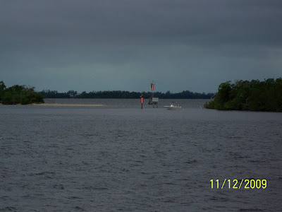
A View From The Channel
Island Hopper left the dock of Venice Yacht Club at 10:30 AM heading to the home port for the winter, The Longboat Key Marina. (http://www.longboatkeymarina.com/) Temperatures were sunny and in the low 80's, winds NW 10 15, with choppy seas. It was another windy day on the waterway.
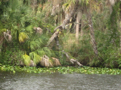
Just One of Very Many Manatee Zones

Estates Along The Waterway

Longboat Key Marina
First Mate Debbie Preparing Lines Prior To Docking

Island Hopper In Port

As Ed Daniel would say, "As snug as a bug in a rug."

Island Hopper arrived at Longboat Key Marina at 1:00 PM. The boat slip is in a wonderful location in the marina. Debbie was happy to hit land and head to Tidy Island. (http://www.tidyisland.org/) Kevin is looking forward to being near Island Hopper on a daily basis. Life Is Good!
Views Of Longboat Key From Debbie & Kevin's Porch
Captain Kevin's Navigation Notes: Final notes from the Island Hopper log of our trip south. We Left Rock Hall, MD on the eastern shore of the Chesapeake bay due east of Baltimore on Monday October 19, 2009. We arrived in our winter home of Longboat Key, FL (near Sarasota) on Friday, November 13. Total miles traveled 1420 statute miles burning 1418 gallons of diesel fuel so almost exactly 1 mpg. WE took 25 days for the journey of which 21 were underway. We planned three nights in Charleston which was reduced to two as we were delayed by high winds in Belhaven, NC for an extra night. We spent two scheduled nights in St Augustine and were again delayed by high winds in Stuart, FL on the east coast for an extra night. WE averaged 68 miles per day which allowed us to arrive early and sight see the small towns along the southeast coast of the US, usually on our bicycles. We enjoyed local restaurants for dinner about 3/4 of the time and cooked on board dinner the balance of the days. Besides a temperamental A/C unit (blown circuit board) which I repaired myself (I carry spare parts on board) we experienced no mechanical problems. Everything hummed, a blessed occurrence on a boat! We had little rain to contend with but we experienced high winds for about 40% of the journey. Delaying us two days but also rocking us a bit from time to time. Docking was challenging with the high winds and current in some of the marinas. My skills at boat handling have improved greatly on this trip. We back in to slips so it is an adventure at times. Great crew on the foredeck is a distinct advantage, I am blessed in that regard, to have my first mate Debbie. Another great adventure on the water, now to enjoy the west coast of Florida one of my favorite cruising grounds., since I kept a sailboat here starting in 1983. Till the next adventure.

Ft. Myers, FL to Venice, Florida

Thursday, November 12, 2009

Gray & Cloudy Skies

Island Hopper departed Royal Palm Yacht Club at at 8:30 AM. It was extremely windy getting off of the dock. A good game plan from Captain Kevin made for a smooth exit. Temperatures were in the 70's, a cloudy and drizzly start with skies becoming sunny in the afternoon, winds NW 15 -25 with gusts to 30, ICW rough.

A Little Bit Of Paradise

An Osprey Nest On The Marker
Sparrow docked in Placida, Florida

Jack And Janice Johnston's Condo In Placida, Florida

The run to Venice Florida was 72 miles with 1 bridge opening at Boca Grand. Island Hopper arrived at the Venice Yacht Club at 2:30 PM. Debbie & Kevin rode their bikes into town for some shopping and coffee. Sharry and Harry Addison came aboard Island Hopper for drinks at 6:00 PM and then the group went to The Crow's Nest for dinner. It was an enjoyable evening. (http://www.crowsnest-venice.com/)

Crow's Nest Marina

Venice Beach About Venice Florida Venice, South Venice, Nokomis, Laurel, and Osprey are five communities that are nestled along Florida's southwestern coast. The waters of the Gulf of Mexico moderate the temperatures of summer and winter for a perfect year-round climate. The scenic stretch of Sarasota County coast line basks in the sun most of the year and temperatures seldom drop below 70 degrees. From Osprey, which is the northernmost community to Manasota Key, below South Venice, fourteen miles of white sand beaches lure sun worshippers and searchers for sea shells and the prehistoric shark teeth which have earned Venice the title of Sharks Tooth Capital of the world. Every August, Venice draws thousands of visitors to its superb waterfront with the community-wide Sharks Tooth and Seafood Festival. Venice, a water wonderland, enjoys the Gulf , bays, and other waterways that offer opportunities for swimming, surfing, fishing, and boating - a constant source of recreation for residents and visitors alike. In 1994, the population of the City of Venice, was estimated at about 19,000; that of greater Venice are at 87000. The five communities cover a total of 80.3 square miles. Thirty-five miles of beaches line Sarasota County's coast. At the heart of Venice is the Downtown Historic District combining the best of past and present while enjoying a modern outlook. Venice is one of the few cities on Florida's west coast that is not separated from the Gulf by a barrier island. Construction of the Intracoastal Waterway in 1963 made an island of the Venice municipal and commercial district and helped maintain the pattern of growth that continues today. Preserving the original character of Venice, the city created the Historic Venice District and an Architectural Review Board to ensure that new construction or modification of existing buildings conform to the northern Italian Renaissance style of the city's original architecture. Designation as a Florida Main Street City by the State further assures the city's heritage will be preserved.

Wednesday, November 11, 2009

Clewiston, FL to Fort Myers, FL

Wednesday, November 11, 2009
Island Hopper left the dock of Roland Martin Marina at 8:00 AM. The morning started out cloudy with a few drizzles. The skies cleared in the afternoon. Temperatures were in the low 80's with winds SW 15 20. The winds were building and gusting in the afternoon. Today's journey had 2 bridges and three locks and a total of 69.5 miles. The first lock had an 8 foot drop and the second and third locks had a 1 foot drop each.
Hyacinths In The Water
Going Into The Lock
Ft. Myers City Dock
Island Hopper had to go slow during the manatee zones, but arrived at Royal Palm Yacht Club's dock at 2:30 PM. Maureen and Jack Donahue came aboard Island Hopper for drinks and then Debbie, Kevin, Maureen and Jack had a wonderful dinner at the yacht club. Jack and Maureen reside in Cincinnati, Ohio and Cape Coral, Florida. They are members of the Royal Palm Yacht Club, Ft. Myers. They enjoy boating on their yacht, Murph's Steamer.

Royal Palm Yacht Club

Stuart, Florida to Clewiston, FL

Tuesday, November 10, 2009
A Waterfront Home
Island Hopper left Sunset Bay Maria at 8:00 AM heading to Clewiston, Florida. Today's journey was 58 miles with 1 bridge and 3 locks. Myakka Lock had divers in the water making repairs on the lock's gate. Island Hopper had to tie to a dolphin and wait 1 hour and 45 minutes for the next lock through. Island Hopper arrived at Roland Martin's Marina at 3:00 PM. The marina is in the very small town of Clewiston. The marina has a restaurant, Tiki Bar, and Ship's Store. (http://www.rolandmartinmarina.com/) Besides that, not much happening in Clewiston. Debbie & Kevin ate aboard Island Hopper and opened a bottle of red wine. Just a relaxing evening on the water.

Tiki Bar

AMERICA'S SWEETEST TOWN Clewiston, historically known as America's Sweetest Town, was incorporated in 1925 and occupies 4.57 square miles with a population of approximately 6,900 people. Clewiston is centrally located in south Florida about 60 miles east of Fort Myers on the Gulf of Mexico and 60 miles west of Palm Beach on the Atlantic Ocean. Through more than a half-century of growth, Clewiston has kept its charm and beauty. We are the Gateway to Lake Okeechobee. Where is Clewiston? Take Route U.S. 27. Clewiston is found on the southwest shore of Lake Okeechobee, the second largest fresh water lake in the United States. The cross-state Okeechobee Waterway offers direct access from either coast by water for boats up to 120 feet. The marinas, motels, and condominiums located on the waterway have dock space and most of the motels and restaurants offer courtesy transportation. Many visitors are attracted to Clewiston because of the excellent freshwater fishing in Lake Okeechobee, offering the best in black bass and pan fishing, including crappie and bream. The City has a protected boat basin with several convenient boat ramps and spacious parking for easy access to Lake Okeechobee. The City's 18-hole golf course is seldom crowded and beautifully maintained. Other City-owned recreational facilities include the lighted tennis courts, library, public pool and water spray park. The Sugarland Park Recreational Facility boasts nine ballfields, racquetball courts, and soccer fields. Clewiston is proud to have the Hendry County Regional Medical Center located here. With the small town atmosphere, recreational facilities, and business opportunities, it is no wonder so many people are looking at Clewiston as the place to raise a family or retire. Clewiston’s temperate climate and tranquil palm-filled vistas make it a town for all seasons.

Monday, November 9, 2009

Stuart, Florida - Sunset Beach Marina

Monday, November 9, 2009
A Lazy Dog Day On The Boat
Notes from Capt. Kevin It has been three weeks today since we left our summer home of Rock Hall, Md, on the eastern shore of Maryland opposite Baltimore on the Chesapeake Bay. We traveled 198 miles to Norfolk, Va in 3 easy days, burning 252 gallons of diesel fuel. since we were mostly on open water we would run on auto pilot at 20, hence the higher fuel burn. The Norfolk to Stuart, FL run is the Atlantic Intra Coastal Waterway (AIWW) which runs to Key West. We are hanging a right at Stuart to cross inland FL using the Okeechobee Waterway which will put us in Ft Myers, FL. The Norfolk to Stuart run is exactly 1000 miles on the GPS, burning 1122 gallons of diesel. I guess I better plant a few trees to make this carbon neutral. Better fuel economy than the Chesapeake as we avg less speed due to restricted channels and manatee zones. WE generally avg 60-80 miles per day which means 6 hours underway. We had four ports where we spent 2 days, Belhaven NC (due to high winds), Charleston, SC, St Augustine, FL and Stuart Fl (again due to high winds). Last prize would be to spend 3 nights in Belhaven, NC. I wiill update the navigation notes after we arrive in our winter home in Longboat Key Moorings.

Reminded Us Of Acacia Flamm

Sailors Return Restaurant

Debbie Riding Down The Dock On Her Mini Downtube Bike

After playing around town Debbie & Kevin ate dinner at Sailors Return Restaurant. It is the new restaurant at the Sunset Bay Marina. Tonight was opening night. The food was great.

Sunday, November 8, 2009

Melbourne, Florida to Stuart, Florida

Sunday, November 8, 2009

Island Hopper left the dock at 8:20 AM heading to Stuart, FL. The temperatures were in the low 80's, sunny with some overcast, winds, 20 - 25 East with gusts to 30, seas a rough chop on the ICW. It was a windy and rough day on the waterway. Island Hopper arrived at Sunset Bay Marina (http://www.sunsetbaymarinaandanchorage.com/ ) in Stuart, FL at 2:00 PM. After fueling Island Hopper traveled to the dock. The crew ate dinner aboard.
Sunset Bay Marina

Island Hopper Tied At The Dock

Key Lime Cafe

Great architecture with the old buildings.

Island Hopper will spend two nights in Stuart, due to the high winds.

WEATHER UPDATE...

This Afternoon: E wind around 20 kt, with gusts as high as 30 kt. A slight chance of sprinkles. Seas 1 ft or less.

Tonight: E wind 16 to 19 kt, with gusts as high as 25 kt. A slight chance of sprinkles before 7pm. Seas 1 ft or less.

Monday: ESE wind 17 to 19 kt, with gusts as high as 25 kt. A slight chance of showers. Seas 1 ft or less.Monday Night: E wind 13 to 17 kt, with gusts as high as 25 kt. A slight chance of showers. Seas 1 ft or less.

HISTORY OF STUART, FLORIDA... In the 1700s, several Spanish galleons were shipwrecked in the Martin County area of Florida's Treasure Coast. The multiple wrecks were reportedly the result of a hurricane, and the ships were carrying unknown quantities of gold and silver. Some of this treasure has since been recovered, and its presence resulted in the region's name.

In 1832, pirate Pedro Gilbert who often used a sandbar off the coast as a lure to unsuspecting prey, chased and caught the Mexican, a US merchant ship. Although he attempted to burn the ship and kill the crew, they survived to report the incident, ultimately resulting in the capture and subsequent execution of Gilbert and his crew.The bar from which is lured his intended booty is named "Gilbert's Bar" on nautical charts.

The Treasure Coast area that became Stuart was first settled by non-Native Americans in 1870. In 1875, a United States Lifesaving Station was established on Hutchinson Island, near Stuart. Today, the station is known as Gilbert's Bar House of Refuge and is on the National Register of Historic Places.

From 1893-1895, the area was called Potsdam. This name was chosen by Otto Stypmann, a local landowner originally from Potsdam, Germany. Stypmann, with his brother Ernest, owned the land that would become downtown Stuart. Potsdam was renamed Stuart in 1895, after the establishment of the Florida East Coast Railway, in honor of Homer Hine Stuart, Jr., another local landownder.

When Stuart was incorporated as a town in 1914, it was located in Palm Beach County. In 1925, Stuart was chartered as a city and named the county seat of the newly created Martin County. The city of Stuart is known as the Sailfish Capital of the World, because of the many sailfish found in the ocean off Martin County. From 1871 to 2005 there have been 19 hurricanes that passed through Stuart. This included Hurricanes Wilma, Jeanne and Frances.

Friday, November 6, 2009

New Smyrna Beach, Florida to Melbourne, Florida

Saturday, November 7, 2009
Traveling On The ICW
Man's Best Friend and Fishing Buddy
Playing On The Water
Island Hopper departed New Smyrna Beach Municipal Marina at 8:15 AM heading to Melbourne, Florida. Temperatures were in the 80's, winds 15 -20 gusting to 30, and seas are predicted 8 -12 on the outside, so Island Hopper will stay on the ICW with seas 1-2 and a moderate chop. Island Hopper arrived at Melbourne Harbor Marina at 2:00 PM traveling 70 miles. ( http://www.melbourneharbor.com/ )
Waiting For The Bridge To Open
Just One Of Many Bridges
Debbie & Kevin rode bikes into town and explored historic Melbourne. There were a lot of eclectic shops. For dinner they went to The Chart House Restaurant.
Menu Welcoming The Hopper Party!!!

All About Melbourne...
The City of Melbourne is located on east central Florida's Space Coast. Melbourne is about an hour's drive south of the Kennedy Space Center, and 1-1/2 hours due east of Disney World. While most of Melbourne is located on the Florida mainland, a small portion is located on a barrier island. The Indian River Lagoon separates the mainland from the island. The island is a narrow strip of land that separates the Lagoon from the Atlantic Ocean. (In prehistoric times the Lagoon was connected to the Ocean. Today, the only connection is by way of a handful of inlets, including the man made Sebastian Inlet at the southern end of Brevard County.) Spanning the Indian River Lagoon to connect the mainland to the barrier island are a pair of four-lane, high-rise bridges -- the Melbourne Causeway and the Eau Gallie Causeway
The contemporary City of Melbourne is the result of a merger of the separate communities of Melbourne and Eau Gallie. An election allowed the consolidation under a common charter on July 15, 1969. Today, the City is approximately 41 square miles in size, with about 75% of that land in use. The City of Melbourne population was 78,308 as of April 1, 2008, according to the University of Florida Bureau of Economic and Business Research. The population of Melbourne continues to grow at a modest rate. Melbourne is located at the the center of a much larger urban area. Melbourne served as an official host city for the 1996 Olympic Torch Relay. The Olympic flame was carried across the nation before reaching Atlanta and the Olympic Centennial Games. Thousands of area residents enjoyed seeing the Torch Relay, which symbolized the competitive and unifying spirit of the Olympic Games.

Mimi & Papa Hoppa miss Ella Francis!!!!!

MIMI IS MISSING ELLA. MIMI CAN"T WAIT UNTIL THANKSGIVING. TOM,AYNSLEY AND ELLA ARE COMING TO TIDY ISLAND!

Ella is HAPPY about seeing Mimi and Papa too!